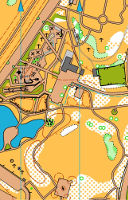
| LOCATION |
COVERAGE |
MAP |
FILES
|
| |
|
A smaller number is LARGER SCALE and more detail |
|
Trentham to Silverstream
Upper Hutt |
Upper Hutt urban area covering part of Trentham, Heretaunga and Silverstream, as used for afterwork rogaines. |
OHV Rogaine/MTBO stds 1:12,000 at A4
Mapping 2021, some updates 2023 |
Trentham 2023 |
Silverstream
Upper Hutt |
St Pats College including farmland to riverbank and Heretaunga Park, as used for afterwork events. |
OHV Park/Sprint stds 1:4000 at A4
Mapping 2021 |
St Pats 2021 |
Trentham
Upper Hutt |
Trentham Memorial Park including Bartons Bush, Moehau Park and part of riverbank, as used for afterwork events. |
OHV Park/Sprint stds 1:4400 at A4
Mapping 2021 |
TMP 2021 and Part enlarged to 1:3000 |
Avalon
Lower Hutt |
Avalon Park and across the river to Belmont School and Domain, as used for Get2Go and numerous afterwork events. |
OHV Park/Sprint stds 1:4000 at A4
Mapping 2021 |
Avalon Park 2021 |
Brown Owl/Totara Park
Upper Hutt |
Beautiful Harcourt Park, connects over footbridge to California Park. There's a permanent orienteering course, but this lets you set your own. |
OHV Park/Sprint stds 1:4000 at A4
2021 Mapping. |
Harcourt Park 2021 |
Tunnel Gully
Upper Hutt |
Tunnel Gully picnic areas, bush tracks suitable beginners, plus little pine area suitable orange/red levels. |
OHV Park/Sprint stds 1:3000 at A4
Mapping 2021 |
Tunnel Gully 2021 |
Central L/H
Lower Hutt |
Central Lower Hutt from Queensgate to the Hutt Rec and across to the Ewen Bridge. Includes reconstruction of the Civic Centre. |
OHV Park/sprint stds 1:3000 at A4
2020 Mapping |
Lower Hutt Central 2020 |
Belmont
Lower Hutt |
Riverbank up and downstream of regional council Pilot Wetland near Belmont School, as used for U-Max. |
OHV Park/Sprint stds 1:3333 at A4
Mapping 2020 |
Two map files: from Pilot Wetland north as far as Belmont Playcentre, and from Pilot Wetland south well south of the bank erosion zone. Crossable zones shown in river at low flow, need to be carefully checked on each occasion. |
Central U/H
Upper Hutt |
Maidstone Park including bush and the ridge behind, as used for U-Max |
OHV Park/Sprint stds 1:6250 at A4
Mapping 2019 |
Maidstone Plus 2019 extends way back and as a result some of the detail in the playground etc is hard to read. |
Korokoro
Lower Hutt |
Percy Reserve and bush up to Maungaraki School, and almost to end Acacia Ave. Beautiful bush reserve includes duck pond, cave, lawns, old house sites. |
OHV Park/Sprint stds 1:4800 at A4
Mapping 2019 |
Percy Plus. There's also a 1:3100 version of just Percy Reserve and Frank Cameron Park at Percy Reserve. |
Mt Victoria
Wellington |
Town belt tracks from Constable St to Palliser Rd. |
OHV MTBO stds 1:8000 at A4
Mapping 2019 |
Used 2019 but mapping may not have been updated then. Mt Vic MTBO |
Central L/H
Lower Hutt |
Central Lower Hutt from the Melling Bridge to the Library, including Queensgate and the Civic Centre. Before the Civic Centre reconstruction. |
OHV Parksprint stds 1:4000 at A4
2017 Mapping |
Lower Hutt Central 2017 |
Central U/H
Upper Hutt |
Maidstone Park - playing fields and bush tracks; updated after 2016 bushfire. |
OHV Park/sprint stds 1:4250 at A4
2017 Mapping |
Maidstone Park 2017 |
Muritai
Eastbourne |
Village, school, beach and streets from Bishop Park to the cricket ground. |
OHV Park/sprint stds 1:4000 at A4
2016 Mapping |
Eastbourne Village 2016 |
Parkway
Wainuiomata |
Waiu Trail Park aimed at bikers but walking fine too, nice easy trails on the flat round wetland, also some adjoining streets (Parkway). Covers wider area than 2018 map. |
OHV MTBO stds 1:7,000 at A4
2016 Mapping |
Wainui Trail Park 2016 |
Days Bay
Eastbourne |
Williams Park, Wellesley College and nearby streets and tracks. |
OHV Park/Sprint stds 1:4000 at A4
2015 Mapping |
Days Bay 2015 |
Kaitoke
Upper Hutt |
Regional Council camping area with bush surroundings, river, barbeques, etc.
See GW's 3min video. |
Old-style Park stds 1:5000 at A4
2015 Mapping. Later much improved mapping under wraps pending event 2022. |
Camp Kaitoke 2015. |
Petone
Lower Hutt |
Park and beach from playground East end of Esplanade to Hikoikoi Res and rivermouth. |
OHV Park/sprint stds 1:4000 at A4
2014 Mapping |
Hikoikoi 2014 |
Waterstone
Paraparaumu |
Lovely little corner of Paraparaumu with residential, parkland, lakes. |
OHV Park/sprint stds 1:3,000 at A4
2012 Mapping |
Waterstone 2012 |
 OHV MAPS